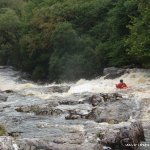
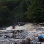
This is a more relaxed run than the Middle Flesk but can also be a nice warm up before it. It is a rocky grade 3 river with one section of grade 4 which is considerably more difficult than the rest.
This run needs a good bit of water. Depending on the level it can be hard on the equipment and the paddler There is a river gauge which is visible from the bridge at the take out. Anything above 90 and you should be laughing. As the river winds away from the road the gradient picks up. The first section is easy grade 3 paddling.
Further downstream you will meet the first sizable drop which signifies the start of the grade 4 section. The first drop is roughly 7-8ft, which should be shot on river left over a ledge. The second drop is smaller, again run on the left, but requires a quick turn to river right into an eddy above the main fall. This fall is a long rock slide about 25 -30ft long. The water is funneled into a channel with sharp bed rock protruding into the flow.
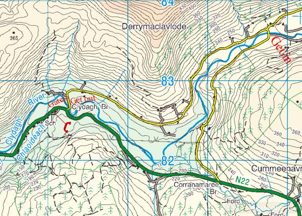
The remainder of the river is similar to the beginning with several small rapids and drops. The river enters a gorge signaling the take out for the Upper Flesk / Clydagh and the start of the middle Flesk. The easiest exit is on river right or left before the rapid at the entrance to the gorge. If your not confident, get off before the rapid, a swim down the following rapid could be extremely nasty.
If you do not intend paddling the middle Flesk, exit here. the next rapid is a grade 4 that curves to the left.
If your continuing on to the middle Flesk check out the guide on it for more details.
Very overgrown
The get out is through a farmer's field, as always respect his fences/gates. The field on river right often has a bull in it now so better avoided unless you've checked.
There is now an exit in the opposite eddy, complete with ropes and carabiners to help.
The farmer at the put in has requested in very strong terms that no vehicles be left on the verges of his driveway. so travel up in the minimum number of vehicles and park on the valley road and not adjacent to the bridge.
If you start at the upper bridge there are no issues and plenty of parking.
Loading levels...
Written by paddlers. If you know this river, sign in and edit these notes. Changes are reviewed before they appear.
See the Gauge visible from the bridge at the get out. 100m downstream. Available on riverspy also.
Levels changed compared to old gauge.
70-90 you might just do the slide
90cm pretty scrapey but doable
110-130 good level
150 high
Typical number of days each month the river is at a paddling level
| Month | Typical paddle days | Driest year | Wettest year | Years with at least one paddle day |
|---|---|---|---|---|
| January | 9 | 4 | 13 | 7 of 7 |
| February | 12 | 0 | 16 | 6 of 7 |
| March | 8 | 2 | 16 | 7 of 7 |
| April | 3 | 0 | 6 | 6 of 7 |
| May | 2 | 1 | 8 | 7 of 7 |
| June | 2 | 0 | 5 | 5 of 7 |
| July | 2 | 0 | 9 | 4 of 6 |
| August | 3 | 0 | 6 | 5 of 6 |
| September | 4 | 1 | 8 | 7 of 7 |
| October | 11 | 7 | 16 | 6 of 6 |
| November | 13 | 3 | 15 | 6 of 6 |
| December | 12 | 8 | 19 | 7 of 7 |
The best months on the Upper Flesk/Clydagh are February, November and December, with 12 to 13 paddle days in a typical month. Summer is hit and miss: a typical June to August month gives only about 2 paddle days, but July had at least one paddle day in 4 of the last 6 years.
How to read this graph. A paddle day is a day the gauge reached between the guide's Low and High levels (0.9 to 1.7 m). Each bar is the middle year of 7 (2019 to 2026). Tap a bar for the driest and wettest years.
How high the river usually gets each day, from 7 years of readings (2019 to 2026)
| Month | Typical daily high | 8 days in 10 between |
|---|---|---|
| January | 0.665 m | 0.408 and 1.44 m |
| February | 0.858 m | 0.453 and 1.709 m |
| March | 0.586 m | 0.368 and 1.299 m |
| April | 0.412 m | 0.31 and 0.967 m |
| May | 0.401 m | 0.298 and 0.919 m |
| June | 0.355 m | 0.28 and 0.784 m |
| July | 0.363 m | 0.286 and 0.902 m |
| August | 0.417 m | 0.281 and 0.986 m |
| September | 0.43 m | 0.314 and 1.193 m |
| October | 0.829 m | 0.421 and 1.657 m |
| November | 0.81 m | 0.46 and 1.572 m |
| December | 0.826 m | 0.426 and 1.494 m |
How to read this graph. The line is the typical daily high; the shaded band covers 8 days in 10. Dashed lines are this guide's levels.
Past levels are no guarantee of future conditions. Readings can be late or wrong: check the river on the day. Level colours, "Running now" and paddle days are a guide only, not a sign that the river is safe to paddle. Read about gauge data and levels.
Levels for this guide: whitewater.guide (CC licensed).
Source: EPA HydroNet, Kerry County Council.
This Section is above the Middle Flesk. Follow the N22 between Killarney & Cork. Take a left for Clydagh Valley and follow the road to the left. Cross over the bridge at the start of the Middle Flesk and turn right. Follow this road to a small bridge that crosses the river further upstream.
As a local and a paddler I am bemused by the reference to the middle flesk,Upper Flesk.The Flesk proper begins when the Loo and The Clydagh meet at Loo bridge on the Kilgarvan Road.The sectionof the Clydagh between Poul Gorm and The Madam's bridge is known as Killeen Clonkeen.Madam's Bridge to the New Bridge is Derrymaclavode.From here up to the Forestry bridge is Derrynafinna/Knocknabro. From here up is referred to as the top of Clydagh.
The Take out is before the bridge that runs into the "gates" on the middle Flesk. You can see the last rapid from the bridge. Have a good look at it before heading upstream.
If you do not intend running the Middle Flesk, get out before the bridge. This leads into a twisting class 4 rapid. The easiest get out is on river right, before the small rapid which is visible from the bridge on river right. If you run the rapid exit river right before the bridge, but this involves a climb out of the gorge, needing ropes to shift boats and paddlers.
Interactive map loading...
River Clydagh
Peter