Limerick, Munster Grade: 3 - 4 6km
0.47 m No current reading or no levels set Out of dateGenerally a nice grade 3. It may not take much more water (than 0.7m on the gauge) to really get quick, so watch out for river rising quickly.
This river is not worth it at less than 0.7m on the gauge and I've only managed to catch it once at that. It takes plenty of recent rain to get a good level though a recent run had no rain in the previous 24hrs but was fed be saturated fields.
It's narrow and tree lined so strainers are always possible. From the get on there is a short paddle to the first slot which is pretty much like a channel cut into one side of what would otherwise be a rock slide. This can be approached head on at normal levels and is about 3 foot wide and flushes - total height is about 4 foot. Another short paddle and it's into a taller rock slide. Take this slightly left of centre. Same again - shortly after this is the tallest slide on the river. At 0.7m on the gauge it's got a hole at the bottom to punch and paddle through. Not getting through makes for a tough schull out.The river from here to the next real feature is a relaxing float with few features. The next feature is more of a drop - similar to the first slot but bigger, faster and more fun it's a pretty narrow slot on river left.
I've seen the river with very high levels before. This one takes the rain and turns it into holes - nothing seems to wash out, it just becomes a IV or V. I can imagine it to go to an entertaining IV- at about 0.9m on the gauge.
High water levels mean inspect everything, which may be very difficult as there are few eddies within sight of the run ins and most banks tree lined. Take great care for potential strainers on about about 0.7m.
Group size; Because of the fast flowing nature of the river and that the banks are not the easiest in the world to jump out on to and lots of "blind" corners i would suggest that group size is kept to smallish numbers. Four paddlers would be ideal but six would be a maximum, In my opinion at over 0.75 on the gauge 6 would be far too many paddlers to have in a single group.
While there has been quite a bit of investment by local anglers the river seems to be seriously valued by the local community. Every time I've been there the locals are very welcoming.
Loading levels...
Written by paddlers. If you know this river, sign in and edit these notes. Changes are reviewed before they appear.
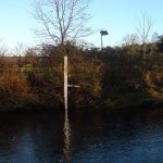
Gauge at get on:
0.7m is runnable with no hanging up on rocks.
0.5m is a scrape but the drops are still good to go.
Typical number of days each month the river is at a paddling level
| Month | Typical paddle days | Driest year | Wettest year | Years with at least one paddle day |
|---|---|---|---|---|
| January | 11 | 4 | 16 | 8 of 8 |
| February | 9 | 0 | 19 | 6 of 7 |
| March | 10 | 1 | 15 | 8 of 8 |
| April | 3 | 0 | 7 | 5 of 7 |
| May | 1 | 0 | 4 | 4 of 7 |
| June | 1 | 0 | 7 | 6 of 8 |
| July | 0 | 0 | 11 | 3 of 8 |
| August | 3 | 0 | 10 | 7 of 8 |
| September | 4 | 0 | 11 | 6 of 8 |
| October | 9 | 4 | 17 | 7 of 7 |
| November | 14 | 5 | 17 | 7 of 7 |
| December | 15 | 9 | 19 | 8 of 8 |
The best months on the White (Abha Bhan) are January, November and December, with 11 to 15 paddle days in a typical month. Summer is hit and miss: a typical June to August month gives only about 1 paddle day, but July had at least one paddle day in 3 of the last 8 years.
How to read this graph. A paddle day is a day the gauge reached the guide's Low level (0.514 m). Each bar is the middle year of 8 (2018 to 2026). Tap a bar for the driest and wettest years.
How high the river usually gets each day, from 8 years of readings (2018 to 2026)
| Month | Typical daily high | 8 days in 10 between |
|---|---|---|
| January | 0.432 m | 0.293 and 0.752 m |
| February | 0.434 m | 0.29 and 0.786 m |
| March | 0.374 m | 0.246 and 0.803 m |
| April | 0.258 m | 0.208 and 0.513 m |
| May | 0.229 m | 0.188 and 0.405 m |
| June | 0.227 m | 0.181 and 0.447 m |
| July | 0.227 m | 0.18 and 0.491 m |
| August | 0.26 m | 0.18 and 0.604 m |
| September | 0.285 m | 0.196 and 0.596 m |
| October | 0.418 m | 0.26 and 0.754 m |
| November | 0.452 m | 0.296 and 0.798 m |
| December | 0.493 m | 0.297 and 0.819 m |
How to read this graph. The line is the typical daily high; the shaded band covers 8 days in 10. Dashed lines are this guide's levels.
Past levels are no guarantee of future conditions. Readings can be late or wrong: check the river on the day. Level colours, "Running now" and paddle days are a guide only, not a sign that the river is safe to paddle. Read about gauge data and levels.
Levels for this guide: whitewater.guide (CC licensed) and this guide's water level notes.
Source: EPA HydroNet, Limerick County Council.
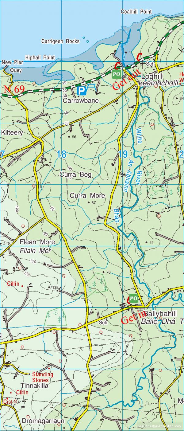
Take N69 from Limerick city (Tralee coast road - signposted for Foynes) and pass out Askeaton & Foynes. Not long after Foynes you will reach Loghill. Take the road that leads up the river left bank - take your time here as cattle are often being moved on this slippy, narrow road. When you reach Ballyhahill, take a left and you'll reach the get on - parking here again is no problem for 3 cars.
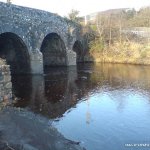
The bridge at Loghill is the get off. Car parking is not a problem on the estuary side of the bridge.
Interactive map loading...
The White river
Peter