Clare, Munster Grade: 2 - 3 5/6 ish Km
1.639 m rising No current reading or no levels setFlat with a three rapids. A couple of bridges for launching off (good crack) and some mildly attractive scenery!
When you get in at the lake paddle over to your left when your looking out at the lake to find the entrance to the river.
1. About 200m down river theres a little weir that can be fun to play on, its a bit shallow though so don't be too ambitious there!
2. Another bit down theres a small foot bridge going across the river and it can be a bit of a hazard at high water and DO NOT go upside down to go under it, theres a log blocked and thats not friendly but at a lower lever there is a sorta bad hole/wave there...would be worth manufacturing a bit - theres a lot of potential.
3.There's about 20 minutes of a flat water paddle down to a iron bridge. If the water is up to the top (or almost) of the triangular yokes you can seal launch of the middle of the down stream side just for the laugh, it the waters warm sure you can jump.
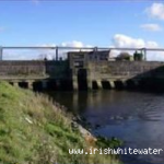
4. A long way down, you'll have passed two bridges, there's a triple drop. It is man-made for fish and the like. you can get out at the river left corner above it and have a look at it from the down stream bridge. Its a bad idea to go through the gates on river left because theres a lot of tow back. the middle tank is cool for stern squirting in if thats what your into. theres also a little tunnel on the river right but its only runnable if its really low.
5. Down through town then theres a drop. Depending on the level it can be a good run, and it turns into a sort of hole/wave at a high level at a medium level its a deadly stopper, I've seen it hold people after the swam. And then you can get out at the slipway there.
Just the stoppers previously mentioned.
In town watch out for the lil' scum-bags throwing stones.
This guide has a gauge but no paddling levels yet.
If you have run it, you can help. Tell us the level it needs to be worth doing (Low), and the best and highest levels if you know them. Once an admin approves them, this guide gets level colours, a place in "Running now" and a count of paddle days per month.
Suggest levels for this guideLoading levels...
Written by paddlers. If you know this river, sign in and edit these notes. Changes are reviewed before they appear.
This guide has no notes on water levels yet.
How high the river usually gets each day, from 8 years of readings (2018 to 2026)
| Month | Typical daily high | 8 days in 10 between |
|---|---|---|
| January | 1.385 m | 1.041 and 1.642 m |
| February | 1.442 m | 1.254 and 1.753 m |
| March | 1.426 m | 1.046 and 1.754 m |
| April | 1.18 m | 1.014 and 1.397 m |
| May | 1.106 m | 0.953 and 1.267 m |
| June | 1.086 m | 0.912 and 1.398 m |
| July | 1.04 m | 0.875 and 1.488 m |
| August | 1.174 m | 0.883 and 1.435 m |
| September | 1.18 m | 0.966 and 1.603 m |
| October | 1.379 m | 1.075 and 1.567 m |
| November | 1.477 m | 1.131 and 1.66 m |
| December | 1.423 m | 1.053 and 1.644 m |
How to read this graph. The line is the typical daily high; the shaded band covers 8 days in 10. This guide has no paddling levels yet.
Past levels are no guarantee of future conditions. Readings can be late or wrong: check the river on the day. Level colours, "Running now" and paddle days are a guide only, not a sign that the river is safe to paddle. Read about gauge data and levels.
Contains Irish Public Sector Information licensed under a Creative Commons Attribution 4.0 International (CC BY 4.0) licence (source waterlevel.ie, provided by the Office of Public Works).
You can get out any where really.
Interactive map loading...
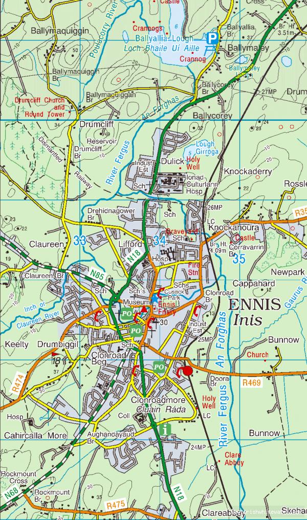
River Fergus
Peter