IrishWhitewater.com Logo
Find a bug, have an idea, email us with feedback
Print Guide Print River Guide

Coomeelan Stream


  Grade:   4 to 6       Rating: river rating
  County:   Kerry   Date updated:15/10/2009
  Section Length:   3.5km   Version: 2 (History)
             

Brief River Description

Too low most of the time. Open hillside to steep wooded valley followed by easy water finishing with a steep section of chutes and even one section underground.

Directions to the Put-in

Head south from Kenmare towards Glengariff on the N71. Go past the first left turn after around 5km. Take the next left about 3km further on. Cross the bridge over the Sheen and turn right. Follow signs for Priests Leap. After about 1km the road runs beside the river at a ford with large stepping stones across the river. Continue up the valley towards Priests Leap to where the road enters open hillside to find the put on.

Directions to the Take-out

Take out at the ford with the stepping stones or for a longer paddle continue on to the Sheen.

River Description

98% of the time, the river is too low to paddle. 1% of the time its probably suicide so finding the other 1% could be tricky. It needs to be during or just after moderate rain.

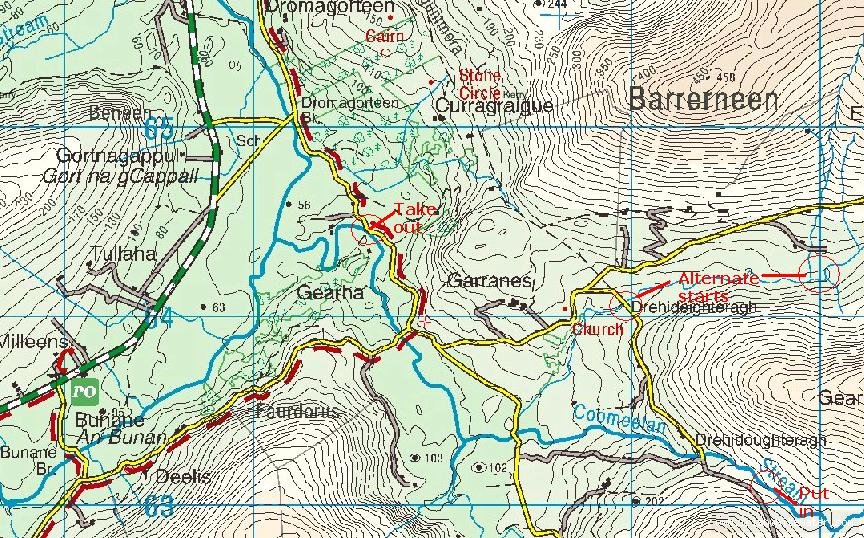
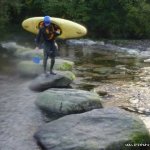
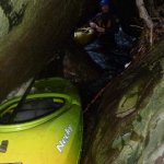
It starts in the open with a narrow winding section leading down to the first bridge. There is a tasty drop at the bridge. (the tree in the photo has been removed) About 50m below the bridge is a boulder choked waterfall that deserves inspection/portage. The next kilometre runs through a wooded valley with continuous drops. In low water, there are plenty pinning spots and in higher water, trees would be an issue. Only scraped along it thus far but at the right level is should be like the Beamish on steroids.

After the 2nd bridge the gradient eases and the flow is increased by the flows from 2 tributaries. The river is Grade 3 until the 3rd bridge.

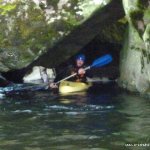
The drop at the 3rd bridge should be inspected on the drive up by driving 50m down a side road to the river. The drop itself is fine but what comes next need serious inspection. The river drops about 10m soon after through a series of scoured chutes in low water and across the whole width in flood. Soon after, the river drops down another chute and then under a hugh boulder for 20m. At high water, this would be a lethal syphon. Smaller drops for 500m lead to the take-out at the ford.

Local issues

If water is high, trees will be an issue in places. Some have been cleared but more remain.

River level gauge

If there is enough to paddle above the top bridge without getting stuck, I'd say its about right.

River Hazards

Waterfall 50m below the top bridge. Danger of trees for the next 1km. Big drops below the 3rd bridge including an underground section which will become a syphon in big water.

Author(s)

Original Author: Daithí
Latest Author: Daithí
(Full History)


Please use the forum for banter or questions.
Please add river details by adding to/editing the guide.


About | Site Map | Privacy Policy | Disclaimer | Contact Us | RSS Feed | ©2009 IrishWhitewater.com