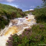
Full on technical and testing run.
The first kilometer of the river is narrow continuous class 3 which upticks quite quickly to continuous class 4. After about 1k there are two tributaries about 500 meters apart on river right. After the first tributary the river begins to get steeper with increasingly technical moves. Almost immediately after the second tributary the gradient increases again substantially and from here until the end it's non stop, continuous, and difficult whitewater with a particularly long stretch of class 5 soon after the second tributary. There are three more big rapids nestled in amongst the last 1k of fast continuous class 4/5 water. Eddies are few and tight. In higher flows the bridge at the end is not passable.
A serious undertaking on to be taken too lightly, it breaks boats and people.
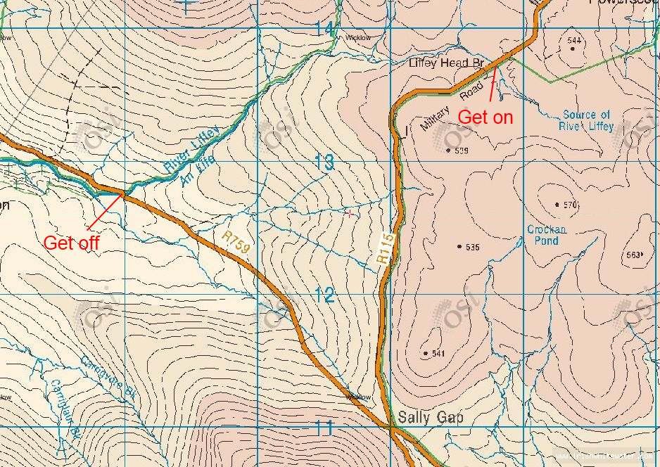
None, no real room for parking at get on so be smart.
Needs lots of water.
Coming from the Upper Liffey get on travelling back towards Laragh you arrive at a cross roads take the left turn along the R115 (signposted for Dublin).
After 3Km you cross a small stone bridge, that's the get on.
Format
Interactive map loading...
Map OS Sheet 56
Adrian S