Avonmore (Clara Vale Section) River
| Grade: | 2 to 2 | Rating: |  |
|||
| County: | Wicklow | Date updated: | 18/07/2015 | |||
| Section Length: | 7km | Version: | 5 (History) | |||
Brief River Description
Mellow enough grade 2, continuous enough at the start and flattens out the further down you go.
Directions to the Put-in
This is the section of River from below Jacksons (Laragh) down to Clara Vale church. Put in either in Laragh at Lynams Hotel (take out for Glenmcnass/Annamoe), or at Ballard Bridge river left side access only. There has been a lot of break-in's in the area. Please don't take up parking at Lynams during busy times for the hotel.
Directions to the Take-out
The Take out is at Clara Vale church, take the R755 out of Laragh towards Rathdrum, until you see a signpost on a lane to the left for Clara Vale church, go down a steep hill and over a bridge which is a take out. This is very tight, and there is not much space for parking. Please don't block it up, or take up the space in the church car park, particularly when the church is likely to be used!
As noted above you can also take out in Rathdrum Village if you wish.
River Description
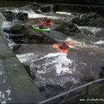
The rapids are all grade two, with no particular hazards. In normal level there are gaps between each of the rapids, but in higher flows these can disappear and trees can become an issue. It is normally a great run for novice paddlers, but be wary at higher levels as wave trains can become quite large and the stretch is quite continuous, making it difficult to recover swimmers and their gear.
The rapids near the start are more frequent and slightly steeper until the picnic site rapid (an actual picnic site which is on river right, if you have no shuttle you can get off here and walk back up to Laragh.) This rapid can easily be run a couple of times as access is easy on the river right bank.
After this the rapids are a bit less frequent, but of a similar standard. You pass Clara Lara water park part of the way down. Descents of the slides in kayaks are no longer possible, as the tops of the slides have been blocked.
A few KM after Clara Lara, you will pass a steep sandy cliff on the river left, this means you are approaching the get-out, which is at the bridge, get out in the church yard on river left. (The eddy here is easy to catch, but a bit small, so be wary with large groups).
If you wish you can continue on downstream a few KM to Rathdrum. This section is not regularly run as the river is shallow for much of the distance. The river needs to be at a medium high level before this section is worthwhile. The character is similar to the few KMs above the usual getout. Beware of a weir just as you are coming into Rathdrum, In high levels it forms a strong stopper which apparently has been the site of fatalities. Can be portaged easily (river right bank) or run down a slide on river right. Take out at the put in of the Rathdrum - meetings of the waters section, this is a concrete slide on river left, eddy will be small (and possibly non-existent so take time in getting down to it.)
Local issues
The area at the get out by the church is small, don't abuse the parking there. The river right bank is private property.
Lynams Hotel don't like paddlers taking over the parking there when trade is busy. Give them some custom if you are there. The soup is good.
River level gauge
Levels can be determined by checking the Avonmore at Annamoe, if it is high this will be high, if it is low, this will be low too. This part of the river has changed a lot in the last year.
River Hazards
Wave trains and encroaching trees can become an issue in high flows.
The weir coming into Rathdrum can be dangerous at high flows should you choose to go on that far.
There is a fallen tree blocking the river 2 or 3 km below lynams.
Author(s)
Original Author: KenLatest Author: John Daly
(Full History)
Please add river details by adding to/editing the guide.


